
Designated Port Areas
What are Designated Port Areas?
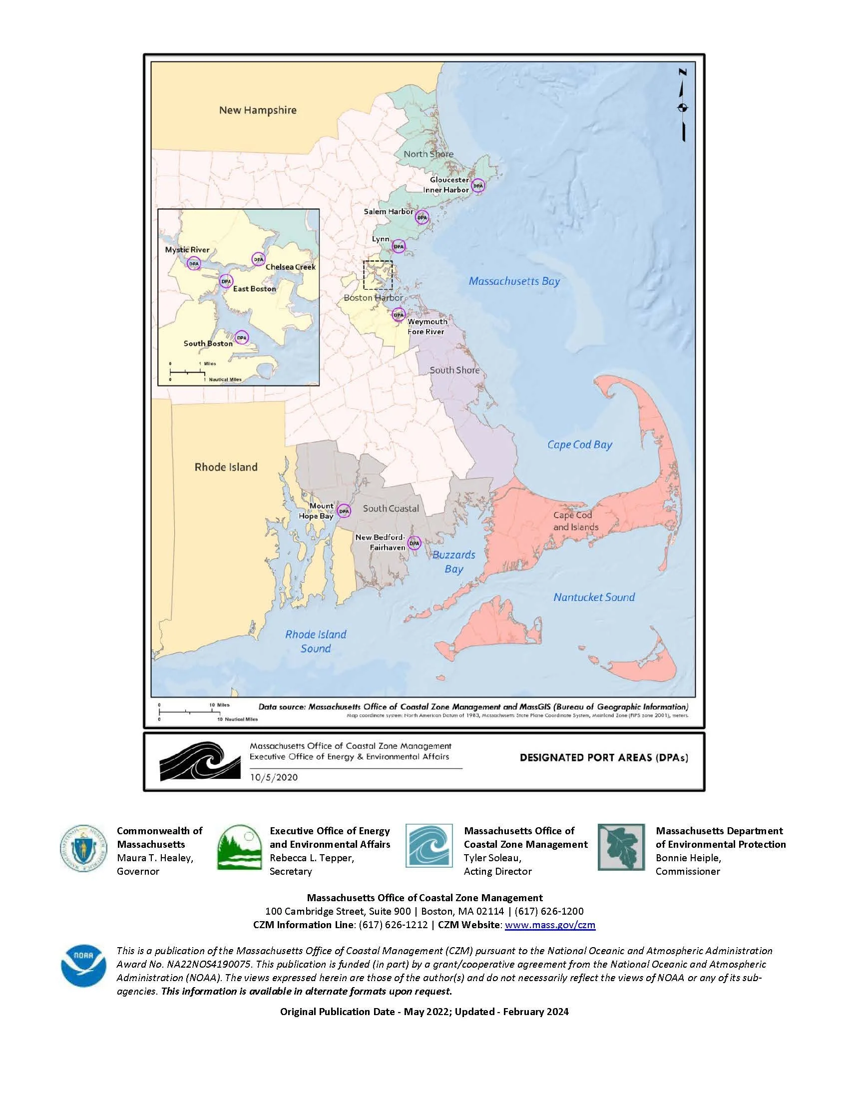
In 1978, Massachusetts established 10 Designated Port Areas (DPAs) to protect and promote water-dependent industries in ports with certain features important to marine industries. The Commonwealth has identified these industries as critical to the overall economy of Massachusetts. DPA regulations are intended to support these industries and protect these areas from being used for other purposes.
DPAs have traditionally supported these types of industrial uses:
Ship building/marine construction
Commercial fishing
Fish processing
Moving goods between ships and shore
Operations that use large amounts of water, such as those for energy, manufacturing, and agriculture
Manufacturing, processing, and production that depend on transportation by water
In recent years, there has been a shift in uses at some DPAs toward warehousing, distribution, and professional and technical services.
DPAs feature these essential components
A waterway and nearby waterfront built for shipping or other direct water use
Land that can be used for industrial facilities and work
Transportation and utility service on land that support industrial use
-
Mystic River (Boston Inner Harbor – Charlestown, Chelsea, Everett)
Chelsea Creek (Boston Inner Harbor – East Boston, Chelsea, Revere)
East Boston (Boston Inner Harbor – East Boston)
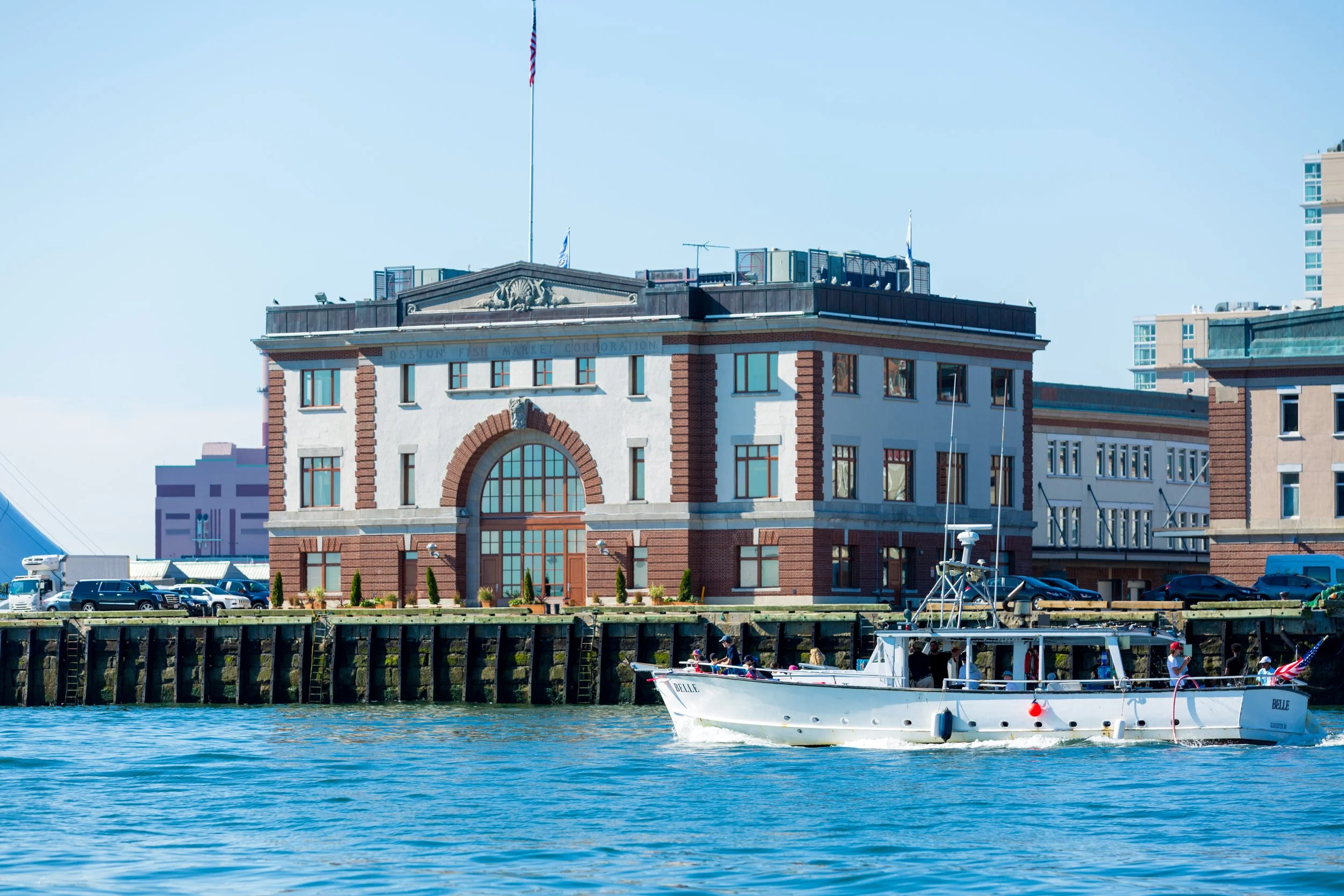
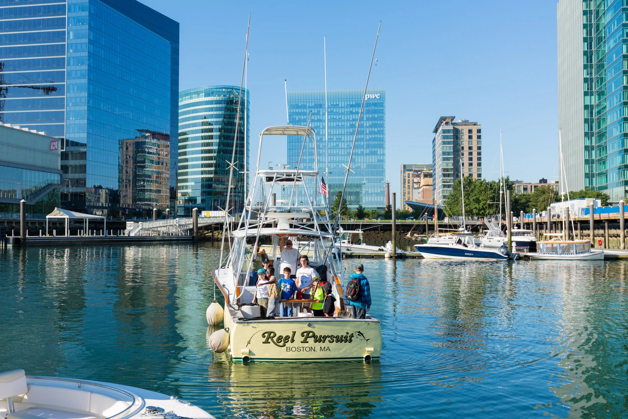
South Boston (Boston Inner Harbor – South Boston, Seaport)
Weymouth Fore River (Quincy, Weymouth)
Mount Hope Bay (Fall River, Somerset)
-
DPA regulations (301 CMR 25.00) work with Chapter 91 regulations (310 CMR 9.00) and Municipal Harbor Plan regulations (301 CMR 23.00). These guide the review and approval of DPA Master Plans.
DPA policy is implemented by CZM on behalf of the Secretary of the Executive Office of Energy and Environmental Affairs (EEA). CZM reviews DPA Master Plans. It also sets, maps, interprets, and periodically reviews DPA boundaries, and is responsible for DPA boundary administration. Through federal consistency review, CZM ensures federal actions and permits related to DPAs are consistent with enforceable state coastal policies.
The Massachusetts Department of Environmental Protection (MassDEP) also implements DPA policy at the project level through Chapter 91. These govern the licensing of structures and uses in the tidelands/jurisdictional areas of DPAs. While some limited supporting and accessory uses are allowed within DPAs, rules require most DPA tidelands to be used or reserved for water-dependent-industrial or limited temporary uses.
Some parts of DPAs are inside Chapter 91 jurisdiction and some are outside. For DPA areas within Chapter 91, the state has strong control over uses, structures, and activities through the Chapter 91 licensing process. For areas outside Chapter 91, local municipalities mainly manage development through local zoning bylaws.
What is the DPA Visioning Project of Save the Harbor/Save the Bay?
Save the Harbor/Save the Bay is leading a collaborate project to create an actionable, stakeholder-supported plan for one or more DPAs that combines:
Concrete visions for future use (place-based, realistic, and illustrative) that garner support from multiple stakeholders, and
Specific regulatory, policy, or funding changes needed to make those visions achievable within or beyond current DPA rules.
We launched this project with partners and support from the Barr Foundation because DPAs in Boston’s Inner Harbor face significant challenges, often do not function in ways that protect and promote water-dependent industrial use, and there is no shared, actionable path forward.
-
DPAs and the land surrounding them are subject to intense real estate market pressures.
The removal of water-dependent industrial land from DPAs threatens their integrity.
Persistent and unmitigated climate risks require urgent action and significant levels of public investment.
Legacy environmental justice issues surrounding DPAs remain largely unaddressed.
There is no forward-looking business strategy and investment plan for Inner Harbor DPAs.
There is a lack of consensus between government and the private sector about what to do in DPAs.
Split jurisdiction and governance of these maritime industrial areas create regulatory complexity and a disconnect with the evolution of neighboring communities and their infrastructure.
Ideal DPA Vision
We envision DPAs that are climate resilient working waterfronts where water-dependent industry and commercial uses, emerging maritime uses, and surrounding communities all thrive. They may blend innovative blue economy industries with traditional water-dependent industrial uses, creating a dynamic business eco-system while addressing environmental justice issues, expanding equitable access, and improving climate resilience.
-
advance statewide climate, energy, and economic goals
address cumulative impacts of legacy polluting industries and support clean and renewable energy and less polluting industries
create good jobs and rewarding career opportunities for all residents with supportive workforce development
allow people and businesses near them to flourish
include climate-adaptive infrastructure to ensure long-term viability and protect surrounding communities
deliver public benefit and equitable access wherever safe operations allow
-
Equity & Environmental Justice: DPAs should reduce harm and increase benefits for nearby communities, particularly those historically burdened by polluting port activity and exclusion from waterfront access.
Public Benefit & Stewardship : DPAs exist to serve a broad public purpose (including economic impact, jobs, climate resilience, access, etc.), not solely private interests.
Climate & Resilience: Any viable future for DPAs must account for sea-level rise, coastal and stormwater flooding, extreme heat, and decarbonization.
Current & Future Context: Decisions should be grounded in actual economic demand and future forecasts, infrastructure constraints, composition of neighboring communities, and regulatory feasibility—not nostalgia or abstract preservation.
Transparent Collaboration: Broad engagement by all stakeholders impacted by DPAs, paired with clear project leadership, and advisory team guidance and decision-making.
Action over Perfection: Partial progress, pilots, and iterative improvement with momentum toward action are preferable to stalled consensus.
Clarity of Scope and Decision-Making: Being explicit about what this project will decide, influence, inform, or intentionally leave unresolved.
Project Advisory Team
We are guided by an Advisory Team with representatives from the Conservation Law Foundation, Mystic River Watershed Association, and GreenRoots and work in collaboration with members of the Boston Waterfront Partners.
Why do DPAs matter to your community?
For people across Massachusetts, DPAs help protect the land and waterways needed for certain water-based industries. The Commonwealth sees these industries as vital to the regional economy. DPAs help keep parts of the coast as working ports with the right infrastructure.
Communities next to DPAs have mixed experiences. DPAs can provide good-paying industrial and maritime jobs. They can also help limit gentrification and displacement that can come with luxury waterfront housing. In some cases, they provide a buffer to some risks like coastal flooding. At the same time, nearby neighborhoods may face air pollution, contaminated land, and extreme heat, and they may have little or no access to the waterfront.

DPA Reports and Resources
CZM Port & Harbor Planning Program - DPAs
Find information on the state’s 10 Designated Port Areas (DPAs) and the role of the Massachusetts Office of Coastal Zone Management (CZM) in the DPA program.
CZM DPA Fact Sheet
For a brief DPA overview, see Designated Port Area (DPA) Fact Sheet - Overview and Contact Information.
Assessment of Massachusetts Designated Port Areas
The Massachusetts Office of Coastal Zone Management (CZM) commissioned Eastern Research Group, Inc. (ERG) to assess the economic impact and the effectiveness of the DPA program across five focal areas: infrastructure and land use, regulatory framework, funding and financing, community impacts, and coastal resilience.
Strengthening the Urban Harbor: Policy & Investment Recommendations for Boston’s Working Ports
The study provides an initial roadmap for the stewardship of Boston's working waterfront, ensuring that these vital economic assets continue to thrive while meeting adjacent communities' needs for open space and adapting to 21st-century environmental and economic needs.
Building Resilience in Massachusetts Designated Port Areas: Resilience for Water Dependent Industrial Users in the Chelsea Creek and Gloucester Inner Harbor Designated Port Areas
The goal of this study is to better enable WDIU stakeholders to understand and address coastal risks. Through stakeholder engagement and a desktop analysis, this study provides a detailed understanding of current and future flood risks facing two of Massachusetts’ DPAs over the coming decades. Building on this understanding, the study provides tailored flood resilience strategies to help address flood risks while continuing to support the operational needs of WDIUs in these DPAs.
Eastie x MIT
Over the course of three years (2021, 2022, 2023) Masters students in the School of Architecture and Planning at MIT have worked with organizations in East Boston to research the neighborhood and create plans to address the challenges Eastie faces today. These plans consider how changes in the economy and climate are affecting East Boston and ways that the city, state, and community can take steps to help the neighborhood adapt to a changing world.